
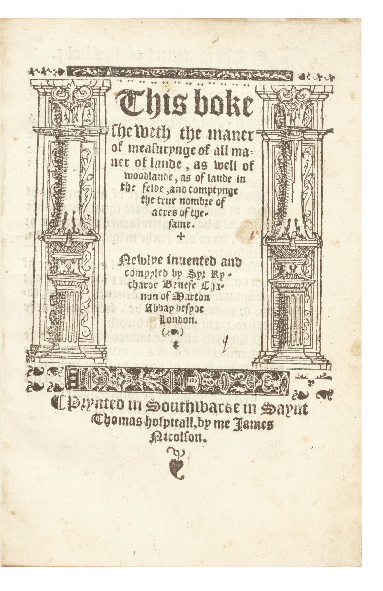
The First English Book on Land Surveying
This boke sheweth the maner of measurynge of all maner of lande, as well of woodlande, as of lande in the felde, and comptynge the true nombre of acres of the same. Newlye invented and compyled by…
Title within architectural woodcut border & many woodcuts in the text (many highlighted in red). Printed in black letter. [208] pp. Small 4to, modern calf (title with a few minor stains). London: “Prynted in Southwarke in Saynt Thomas Hospitall, by me James Nicolson,” [1537].
First edition of the first English work on surveying in the modern sense: the measuring and plotting of land. In the 16th century, “surveying” could also mean giving instructions to land stewards and overseers of the manor; John Fitzherbert wrote the first book on that subject in 1523. Our book is very rare and is a fine copy.
Benese (d. 1547), Augustinian canon and surveyor to Henry VIII, noted that sellers tended to overestimate the size of the land they were selling and buyers underestimated. He set out to devise geometric rules for the accurate measuring of land to be sold.
This book “represents the first real attempt to put into the hands of the surveyor or land measurer, as distinguished from the sixteenth-century manager of a manor, a simple practical treatise on land surveying. The style is simple, and the explanations are clear and direct; the book gives every evidence of having been written by a person familiar with the practical art of land measuring…
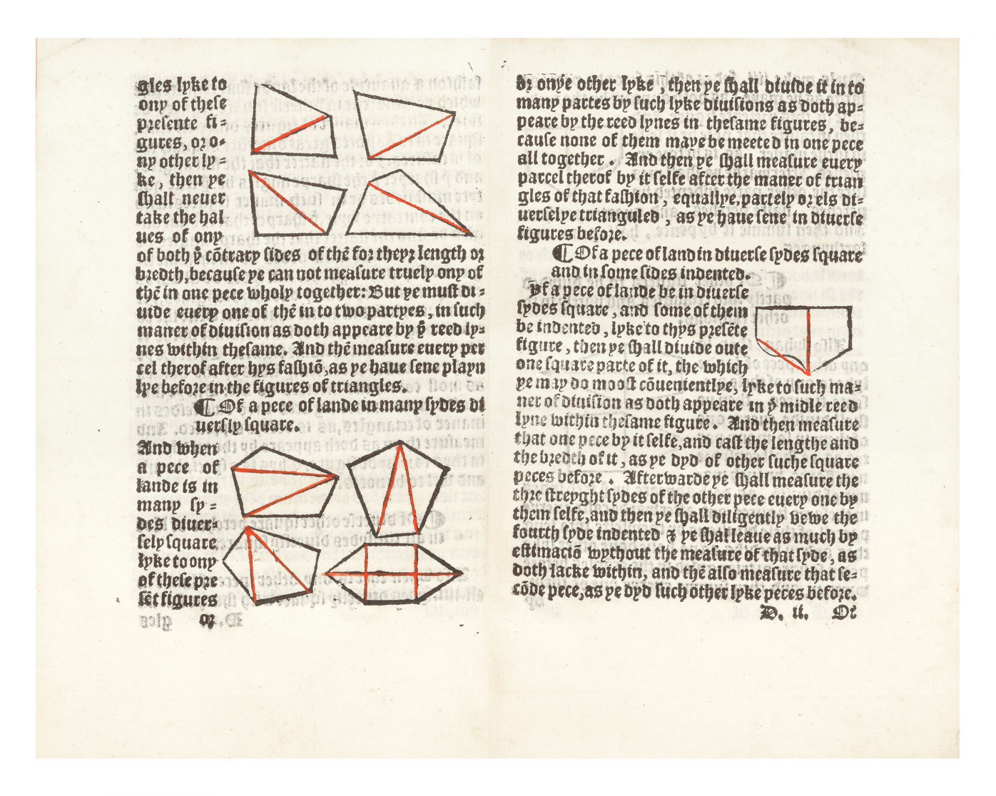
“The book is not divided into chapters, but each unnumbered section is headed with an appropriate title. The text as a whole is illustrated with forty-eight well-drawn and appropriate figures. In the first three folios, the author defines the units of line measures, stating that the standard foot should be the London standard of 12 inches…
“After the units of length and land measures have been defined and discussed, the author gives methods of finding the areas of certain simple geometrical figures, principally triangles, rectangles, trapeziums, and circles. Benese does not give a general method of finding the area of any of these but discusses each type of figure as a special case…Benese realized the lack of computational skill on the part of most of his readers; to meet this difficulty he prepared four sets of tables…to aid in the determination of the areas of figures and also in laying out parcels of land of different sizes and shapes.”–Richeson, English Land Measuring to 1800: Instruments and Practices, pp. 36-37–(& see pp. 35-40 for a full account of the importance and contents of this work).
The preface to this work was written by Thomas Paynell, the prodigious translator and humanist. He places this work in the noble and learned scientific tradition of geometry that had enabled Archimedes to measure altitudes and the motions of the planets.
Fine copy. A few ink annotations in two early hands.
❧ ODNB. NSTC 1873.
Price: $45,000.00
Item ID: 6565